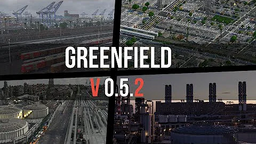
Update 0.5.2
Update 0.5.2 is the twelfth revision of the Map, introducing the ghettos of Westwood, and the industrial ports of Gamma Pier, Zeta Pier, and Epsilon Pier. This update was first announced on June 24, 2019, and was released on July 12, 2019.
 0.5.2 Update Trailer Thumbnail | |
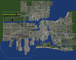
 Extent of the update during 0.5.2 | |
| Release | July 12, 2019 |
|---|---|
| Building progression | March 2018 - June 16, 2019 (14 months) |
| Open server | July 8, 2019 - July 11, 2019 |
| Version | 1.13 |
| Areas introduced | |
| Areas modified | |
| Preceded by | 0.5.1 |
| Succeeded by | 0.5.3 |
Westwood
Westwood is a designated community area on the west side of Greenfield, California.
History
Back in the early 20th century Greenfield saw a massive boom in industrial expansion and therefore needed to expand further west of the city. This was urgent because a ton of residents were displaced in order to build a port right next to Barons Bar. In the 1900s this brand new residential/industrial area would be Westwood. The neighbourhood was mostly made up of regular single-family homes or duplexes and other things alike, with wall-to-wall commercial buildings along the grand avenue's. Multiple factory buildings were placed along the canal and towards the port which made a direct acces to the railroads leading in and out of Greenfield. The current passenger railroad was relaid onto a small elevation held up by concrete walls which goes right through the neighbourhood with a train station being built on one of the main avenue's. And multiple bridges were constructed that connected Westwood and Ashfield west which made transporting goods easier with cargo-vehicles. Westwood and it's neighbouring districts generated alot of income for the city.