SR-110
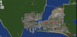
State Route 110 (SR-110) is an east-west state highway that links Downtown Greenfield with Rio Pueblo to the east. It is the shortest highway within the city.
Route description
Western Half
Starting in Downtown Greenfield, SR-110's western terminus is at I-105. Heading west, I-105 access is limited to east only, however it is possible to head west on I-105 via surface streets. After crossing a bay, SR-110 bypasses Eaglepoint, with access at Exit 1. SR-110 also bypasses Lakeview and Whitestone, with access at Exits 2 & 3, respectively. Therefore, access to Greenfield Eastern University requires one to get off the freeway at Exit 3. SR-110 is 6 lanes throughout the western half.
Eastern Half
SR-110 will go through a pair of tunnels under GEU. When it emerges out, it will have an interchange with I-10, which provides access to Rockwell, Greenfield International Airport, and ramps to Los Llanos. SR-110 will finally go over a long overpass where it terminates near Rio Pueblo. SR-110 is primarily 6 lanes throughout the eastern half, however in the I-10 interchange, SR-110 has 4 lanes.
History
The history of the Greenfield's interstate system dates to the 1950s, when the federal government began to invest in the construction of a network of highways across the United States. The goal of this program was to improve transportation and promote economic growth by connecting cities and states across the country. In Greenfield, the construction of the interstate system began in the late 1950s, with the construction of the first section of what would eventually become State Route 110 or SR-110. Originally designed to connect with I-205 via Whitestone, Los Llanos, and Palma, SR-110 is still under construction, with right-of-way funding in the process currently.
